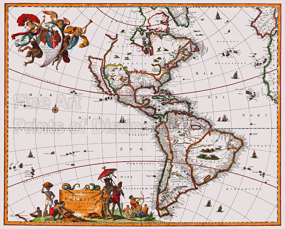
1658 Visscher Map of North and South America
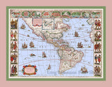
A Museum Quality Print of 1658 Visscher Map of North and South America. for sale by Brandywine General Store. Our premium archival artwork of this map, drawn by Nicholas Janzoon Visscher, covers all of the new world as well as the extreme eastern parts of Europe and Africa. This map due to its wide and various different editions became one of the dominant representations of America well into the early 18th century. The most glaring mistake of this map is California is shown as an island and the Great Lakes are rendered as a single body of water that is open to the west, instead of the 5 individual lakes. North of California is the land and straight of Anan, which is generally considered to be an undiscovered land or strati in the extreme northwestern parts of America, the earliest known reference to Anian is in the narratives of Marco Polo, who describes it as East of India, this area was usually associated with the Northwest Passage. Surprisingly, the Rocky Mountains and the Sierra Nevadas are fairly accurately portrayed as well as a lake in the middle which could be the Great Salt Lake, but this area would not be explored and charted until 150 years in the future. Most likely, he added this lake as the source of the Colorado River which he calls Rio del Norto. The cartography of South America is nearly as poor as North, even though at this point in history the outlying borders of South America were well charted, but the interior still largely unexplored. Visscher even has the Amazon misplaced in accordance with its relations to the other great South American Rivers such as the Paraguay. He also recognizes two popular misconceptions regarding the mythical kingdoms of The Amazon, El Dorado and Xarayes. This map was dedicated to Cornelius Witsen, whose allegorical armorial crest, with victorious angels and a fallen devil appears in the upper left corner. Witsen was an important figure in Dutch politics, holding a post as governor the Dutch West Indies Company and a member of the Dutch Admiralty, he was so honored on this map to lend it importance. The Visscher family were prominent Dutch map publishers for nearly a century. Picture #06 an archival cartographic print of an antique map by Brandywine General Store.

